Showing posts with label Maps. Show all posts

Friday, March 25, 2022

1950 Census - Ancestry's Explore Maps Feature

     While checking out Ancestry, I stumbled across a new feature I had no idea existed. Have you seen it? It's the "Explore Maps" section for the 1950 Census. What is this you ask? Well apparently you can explore Enumeration District Maps right on Ancestry.com. You can search for an address and it takes you right to that Enumeration District map. Game Changer!

Explore Maps
Ancestry.com

    So after I clicked on the "Explore Maps" button, it took me to a page with prompts to explain how to use this feature. 

Welcome to 1950 Census District Finder
Ancestry.com

    After clicking through, I learned that you can search by an address and it is supposed to find the Enumeration District for you AND bring up the map. Intriguing. And will it work for streets that I can not find on the Enumeration District? Oh we are going to put this to the test right now. 
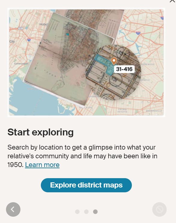
Start Exploring
Ancestry.com

    After I clicked, "Explore district maps", it took me through a series of prompts explaining how to use the page and what all the buttons are for. I will let you go through those yourself when you visit this page. I decided to dive right in and see how well this was going to work. First, I started with an easy address. Easy meaning I had no trouble finding this Enumeration District when I was looking originally. I started with my Great-Grandma's address of 102 N. Clay, Kirkwood, Missouri. 

Search Option
Enter address to search for district map
Ancestry.com

    As you can see, when you start typing an address, it brings up options for you to chose from. Very handy. The address I needed was the first option. So I selected that and clicked "Search". Here is what it brought up.

Search Results
102 N Clay, Kirkwood, Missouri
ED 95-75
Ancestry.com

    Oh my gosh! Look at that! Now, you can zoom in much closer than this to get a view of the map. But yes, this is correct! Very impressive! But what about streets that didn't exist on the map or were labeled? If you read my last blog post, you will see I had some difficulty tracking down a couple of Enumeration District maps because the streets were not on the maps. Read it here: 1950 Census - What if you can't find a street?

    So I decided to put it to the test. I chose the address 9223 Coral, St. Louis, Missouri. This street was NOT on the Enumeration District Map because they used a map from 1942. That street did not exist in 1942, but it did in 1950. I know because my Great-Grandparents lived there. Confirmed by Family and City Directories. So it took some time to find the correct map, but with the help of Google Maps, I found it. So what is this going to bring up if I search it? Hmm...

Search Results
9223 Coral, St. Louis, Missouri
ED 95-315
Ancestry.com

    Holy Cow! The search engine actually found it! Do you see what I mean? The street isn't even on the map. I can't believe it. So just like what I did, they used other maps to find where the street was and in turn found the correct Enumeration District. Well, I'll be. 
There are other features that include changing the opacity to view today's map underneath. That's how they were able to determine where the street is.

Opacity Option
Ancestry.com

    If you look to the right of the image, you can see the Opacity Option. You can slide the circle back and forth to change the opacity of the Enumeration District map, so you can see what it looks like today. I haven't played around with all the features yet, but this is cool!

    If you look to the left of the image, you see you can share a link to this map. So you can share this with family and friends (more than likely friends, cause let's be honest, your genealogy friends are the ones who get it). It will create a unique link for you to share. Here is the link I created for this map. Click here: https://www.ancestry.com/discoveryui-content/district-map/62308?search=9223+Coral%2C+St.+Louis%2C+Missouri%2C+USA&selection=-90.314985%2C38.551325 *Side Note: You will need to have a subscription to Ancestry to view this map.

    As you can see, this is still in Beta testing mode, so not everyone will have access to this yet. Plus, I believe you will also need an Ancestry subscription to be able to use this feature. I have not tried playing with everything yet as I literally just found this. I wonder how well it works with streets that have changed names as I haven't come across that in my research. But what about Rural Route Numbers? Hmmm...

    I have a 2nd Great Aunt & her 2nd husband that moved around a lot during this time. 2nd Great Uncle Howard Kelley was an architect and he traveled to different parts of the United States for work. Mom said they even lived in the territory of Alaska at one point. She remembers him sending her an Eskimo doll when she was little. Well, one address I have for them is where they settled in Carmel, Indiana. The official address is RR1 Box 60, Carmel, Indiana. That is a tricky address to find on the Enumeration District map. So let's try this.

Search Option
Enter address to search for district map
Ancestry.com

    Holy cow! It actually has this address as an option in the drop-down menu! Are you kidding me? I did NOT expect this. Ok, I selected it. What will it bring up?

Search Results
RR1 Box 60, Carmel, Hamilton, Indiana
ED 29-11

    I can't even believe it. This was an address I could not find on the Enumeration District Map. I had three options depending on where they lived, but this narrowed it down for me. I am just blown away. Lisa Louis Cook had a great video instructing us how to find locations if you only had a Rural Route Number for an address. Watch her video here: 


    I think it's safe to say, I am blown away by this new feature on Ancestry. While I've already found most of the Enumeration District Maps for my ancestors, this is still really cool and can be very helpful to others.

    Downfalls
Ok, one big downfall for this is it appears you have to have an ancestry.com membership to use this feature. I have not confirmed that yet because 1) it's in beta test so not everyone will have access 2)I have a membership account so it obviously showed up for me. Now, I did check a secondary account I have, but again since it's in beta test, it didn't show up for that account. So I am unsure if this will be rolled out to be available to everyone when the 1950 census becomes available or not. 

Another downfall is this is being released just days before the 1950 census is released, so almost everyone has done their research and found the ED maps they need. At least I assume so, because I know I have.

A third downfall is a lot of people are waiting for the Preliminary Index to be released before they do anything, so they won't even mess with this. I could be wrong, but that's just my thinking.

And the last, but big, downfall is that Ancestry is not as up-to-date as the SteveMorse.org One-Step website. Joel Weintraub, one of the developers of the site, put the Ancestry search through an extensive test and found some issues. One big one is an ED was divided up after the fact, Ancestry doesn't have those updates, BUT the SteveMorse.org website DOES have the updates in their search.

    Otherwise, I have to say, I am very impressed with this new feature. As I showed you above, it helped me narrow down a location for my 2nd Great Aunt & Uncle in a Rural area. And it also can help if a street was not available on the Enumeration District Map at the time. But I will still be cross-checking the findings with the SteveMorse.org site.

Side Note
    I am still impressed with how easy it is to navigate the SteveMorse.org website and all the work that has gone into their site to help us as researchers. There are so many search features and helpful tips that have been made available to us that it can not compare with anything else. Plus, IT'S ALL FREE!! Don't forget that. So while this new feature by Ancestry is definitely helpful, I will still be using the SteveMorse.org Website for much of my research because of the accuracy of their resources. 

If you have an Ancestry.com membership, head over and see if you can use this new feature they are beta testing, and let me know what you think. Who are you hoping to find? Did this help you locate a map that previously could not locate? 

Oh by the way...


Wednesday, March 23, 2022

1950 Census - What If You Can't Find a Street?

     During this whole process of preparing for the 1950 census, the SteveMorse.org site has been extremely helpful. I have located so many maps and Enumeration Districts for my family through their One-Step site. And their transcriptions of the Enumeration District descriptions have really narrowed down which Enumeration District I needed for my families. But what happens if the street you are looking for doesn't show up during the search?
    That happened to me recently when I was trying to look up an address for some family in Texas. I knew the address was correct because I talked with the family member who lived there in 1950. But no matter what I did, I couldn't find the right map. Eventually, I did locate the right map and Enumeration District, but it took some extra steps that I wanted to share with you. Here are two ways that I was able to find the Enumeration Districts when the streets didn't come up.

1. Use nearby streets

The Census Bureau would use whatever maps they could get their hands on, so the map used might be older than 1950. And the street may not be on that older map. That happened with a different address I was looking up. I knew the street existed in 1950 as I had a 1950 city directory. But it wouldn't show up in the search. So I searched nearby streets and found the correct ED Map. 

I used Google Maps to help me find the location of Coral Drive first. I looked at the surrounding streets and chose a couple to search by on the SteveMorse.org site. That brought up the map I needed. Then I went back and forth between Google Maps and the ED map to find the location of where the street should be. The ED map was put together in 1942, so that's why the street did not show up. It hadn't been developed yet. See the map images below.

1950 (1942) Enumeration District Map
Affton, Missouri
Coral Drive is supposed to be in the circle

Google Maps
Affton, Missouri
Coral Drive is in the circle

Thanks to the surrounding streets like Weber and Fayette, I was able to find the area where Coral Drive should have been.


2. Use Google Maps to find specific areas

I already touched on using Google Maps in the previous tip, but this is a different way Google Maps can be helpful. What happens when you can't bring up ANY nearby streets? That's what I ran into with this next example.

I am not familiar with this area like I was for the last address. I searched for the street, Darcus, on SteveMorse.org but nothing came up. I saw a Dorcus and thought it was maybe a misspelling, but, nope, that didn't come up on Google Maps. I tried to search the nearby streets and still couldn't come up with anything.

Finally, a search of the area of Houston, Harris County, Texas brought up the following Map in a collection. But as you can see, there was a big blank section of the map.

Texas (TX) - Harris County - Houston - ED 263-565
https://catalog.archives.gov/id/48301885#.YjsqRLNxePU.link

As you can see on the map, there are different areas mentioned in the blank area. I compared this with Google Maps. I found Bellaire, West University Place, and Southside Place. The Point is where Darcus Street is located.

Google Maps
Houston, Harris County, Texas

I went back to the SteveMorse.org site, and for the city dropdown menu, I selected West University Place since that was on the map and it's near Darcus. This is the map that came up.

Texas (TX) - Harris County - West University Place - ED 101-6 to 24
https://catalog.archives.gov/id/48301911#.YjsxaOBpbbA.link

While I thought this was going to help me find the Enumeration District but I was wrong. After comparing this to Google Maps, the street, Darcus, appears to be right in the area of South Side, which has no ED listed, nor does it have the street name listed. 

Google Maps
Southside Place, Houston, Harris County, Texas
Darcus Street is the point

Well, this explains why the street didn't show up when I searched for it. But is there a map that has an ED listed? Back to the SteveMorse.org site. For the city dropdown menu, there was another option to try: Houston Vacinity. I checked through that collection of maps and came across the following map.

Texas (TX) - Harris County - Houston - ED 101-4, 5
https://catalog.archives.gov/id/48301901#.YjtQTMQdK2Y.link

I had to zoom in on this map, but I found what I was looking for.

Texas (TX) - Harris County - Houston - ED 101-4, 5 (Zoomed in)
https://catalog.archives.gov/id/48301901#.YjtQTMQdK2Y.link

The circled area is Southside Place. Once again, it does not have the streets listed in that area. But thanks to Google Maps I was able to find the surrounding areas and narrow them down. I wouldn't have known they were divided up by different "towns" or "areas". So make sure you use Google Maps to help you learn more about the area to find the correct map.

These are just two ways that I was able to find Enumeration Districts when the streets couldn't be found on the SteveMorse.org site. The site was still extremely helpful to narrow down the choices to find the right map. Have you had trouble finding Enumeration Districts because the streets weren't listed? What did you do? 


Time Left Until the 1950 Census is Released!


Thursday, February 24, 2022

Maps of Clinton County, Missouri (How Galen & Pearl Met Cont.)

    The recent 52 Ancestors Prompt, Courting, took me down a road where I found more information than I was expecting. On my quest to learn more about the area where Mark's Grandparents met, lived, and were married, I came across some sources that opened up a new perspective for me. While researching the area trying to get an understanding of where everything was located (The School, the Church, the Swope Family, the Berryman Family, and the town), I discovered some maps of the town from that time period. I had mentioned that the town was small and surrounded by farms. I was curious how close everyone was to everything. Well, I was in for a surprise.

    To recap, Galen Swope would stay with his parents when he would come back to town from Kansas City and Pearl McGrew was renting a room from the Berryman family while she worked as a teacher for the Martin School. The 1930 Census shows where they lived.

1930 US Federal Census
Mildred Mcgrew
Platte Township, Clinton County, Missouri
Source: Ancestry.com

1930 US Federal Census
Galen Swope
Lafayette Township, Clinton County, Missouri
Source: Ancestry.com

    I found these maps online after doing a Google Search. The first map shows the Plats of land that belonged to J.A. Swope and R Berryman. The 1930 Census told me that they both owned their properties, so that told me to look at these maps. Look how close the Swope Farm and the Berryman Farm were to each other. 
    The second map shows the location of buildings. Black squares were houses. There were a couple of houses right near each other that could have the Swope's house and the Berryman's house. 

Map 1
Plat book of Clinton County, Missouri
Lafayette Township
Missouri Plat Books cir 1930
Source: Missouri Digital Heritage

Map 2
Plattsburg, Missouri
cir 1926
Source: Old World Maps
Courtesy of USGS

    There are a couple other things written on Map 2 that caught my attention. First, Martin School. That's the school that Pearl taught at. Map 1 does not have the school listed because the first map is for Lafayette Township only. Map 2 has Lafayette Township and Platte Township, where Martin School was located. So I found the Platte Township map & combined it with Lafayette. See Map 3 below. If you look in square 11, you will see a dark square which is labeled "school". Looking back at Map 2, you can see that is where Martin School was located.

Map 3
Plat book of Clinton County, Missouri
Lafayette Township & Platte Township
Missouri Plat books cir 1930
Source: Missouri Digital Heritage

    There was something else I noticed on Map 2. West of the Martin School is Lebanon Church. That would be the Lebanon Baptist Church that they attended. Now when you look back at Map 1, I circled a cross on that map. That would be the location of Lebanon Church. Do you see where that's located? Right next to the J.A. Swope property! So everything was right there along the same road.
    This is really neat! And helpful. I now have a better understanding of the area. Mark and I plan on making a trip out to this part of Missouri hopefully this year. When we traveled out there a few years ago, it was tricky trying to find where the old farmhouses were and where the location of the Church used to be. The cemetery used to be opposite the Church. While the church is gone, the cemetery is still there and that's where a lot of Mark's family is still buried... including Galen & Pearl Swope.

Lebanon Cemetery
Stewartsville, Missouri
Google Maps

Galen & Pearl Swope Headstone
Lebanon Cemetery
Stewartsville, Missouri
July 2014

    It's amazing what else you can learn about family when you start looking a little deeper. I never planned on looking up maps for the area. I never thought about looking up the location of the farms, the church, or the school. Just goes to show you, just when you think you can't research anymore, there is always something. 

Read the post about the Prompt that started this all here: Week 8: Courting (How Galen & Pearl Met)


Monday, February 7, 2022

Week 6: Maps (1950 ED Maps)

Week 6: Maps

The Week 6 theme is "Maps." They say X marks the spot. I don't know if that's true, but I do know that maps are great resources for our research! Think about a time when a map helped you discover an ancestor. Another way you could approach the theme is think about an ancestor would could have really used a map. Feel free to be creative!

        When I first got into genealogy research, I never knew how invaluable maps would be for my research. But as I went along, I found myself looking up more and more maps to understand my family: where they lived, where they worked, where they moved, how did boundaries change, etc. By viewing maps, I learned more about my family than thought I would.
    While trying to decide what/who to write about for this prompt, a couple of options came up: 

  • I wrote a blog post back in 2019 for the 52 Ancestors challenge called "Map It Out" where I talked about using Google Maps to pinpoint where all my family lived in comparison to each other. I could go into more detail about that experience.
  • When researching my great-grand Uncle, William Ilg, and his death in World War I, I was able to view a map at the Research Library in Forest Park (St. Louis, Missouri) to pinpoint the location whereabouts he would have died. Then I used the NARA website to find the EXACT location. That was fascinating!
  • When trying to find the marriage record for my grandma and her first husband, my Aunt Patty instructed me to check the local map of the area to see what churches were near where they lived, and then contact them to see if they have any record for the marriage of them. And it worked!
  • My Uncle Marty shared a map with me a few years ago showing the old properties (Where they currently lived) and who owned them in the late 1800s. It helped put into perspective the stories they told about this family and that family and how this land came to be owned by this person, etc. 
What Should I write about?
    While all these ideas would be interesting to write about, the best choice to make right now would be to write about the Enumeration Maps that were used for the 1950 Census. These maps are an invaluable tool, especially right now since (at this time) the 1950 census is not available and when it does become available, it won't be indexed right away.
    When I first got into genealogy research in 2012, the 1940 census had just been released. That was my first taste of a census, but I didn't know ANYTHING about Enumeration District maps. I've studied quite a bit about them in the past year, and I'm still not even close to being an expert. I suggest checking out my blog post that lists many helpful resources regarding the 1950 census and Enumeration District Maps. Those sources are what I used to help me understand how to use the ED Maps so I'm prepared when the 1950 Census is released.

What are Enumeration District Maps?
"The area that each enumerator covered was called an Enumeration District. Enumeration districts varied in size from several city blocks to an entire county depending on the location. In each state, an enumeration district is given a unique number including two different numbers separated by a dash (i.e. 15-1). The first number is the assigned number for the county and the second number is for each district within the county." Source: NARA Blog - The Unwritten Record

    As I stated, when the 1950 Census is released, it will not be indexed right away. This is where these maps come into play. The Censuses are organized by State, County, City/Township, and Enumeration District (ED). So you have to know what ED your ancestor was living in to know where to find your ancestor in the Census. This also means you need to know WHERE your ancestor was living. 


    Once you have the address for your ancestor, you head over to the SteveMorse.org website to find the ED Map. There are quite a few steps you have to go through to get to your correct map, but it is way more efficient than trying to page through each map to find which one you need, which is what you would need to do on the NARA site. So thank you to Steve Morse, Joel D. Weintraub, and David R. Kehs for creating such a useful tool for us.

How to find the ED Map:
  1. Go to SteveMorse.org

  2. On the left-hand side, hover over "US Census", then select "Unified 1880-1950 Census ED Finder" from the menu
  3. Select the State, County and City/Town from the drop-down menus
  4. Once you do that, an option should appear to add the house number and street name; add that info
  5. Underneath that, Links to Enumeration Districts should show up; If there are many links, you can narrow it down by selecting cross streets that surround the block of where your ancestor lives; you can find this out by looking at Google Maps of the address
  6. Google Maps
  7. Once you are narrowed down to one ED, you can look up the map; DO NOT CLICK ON THE LINK AT THIS TIME

  8. Open up a new tab and go to SteveMorse.org again

  9. On the left-hand side, hover over "US Census", then this time select "1940 and 1950 ED Maps" from the menu
  10. Make sure it says 1950 at the top of the page; then select the same info as before from the State, County, and City/Town from the drop-down menus; Click "Get ED Map Images"; a new window will open
  11. If the correct ED is within the range listed, you have found the right maps; click on the NARA link to open up the maps in a new window
  12. If there are many maps in the collection, scroll through to find the Map that matches your ED number
  13. NARA Website

  14. Once you do, zoom in to the correct ED on the Map to see where your ancestor would have lived; you might need to use Google Maps first to get a general idea of where they lived
  15. 1950 ED Map
    Kirkwood, Missouri
    Google Maps


There you have it! Now you have the ED number to look up your ancestor in the 1950 census (when it comes out) and now you have a map of the area! I used this exact method to find the EDs for the ancestors I am going to look up for the 1950 Census. The case above is for my great-grandma, Nellie Fuchs. She lived on North Clay in Kirkwood, Missouri. I knew the address from City Directories and the location because my dad took me there one time. He remembered visiting her when he was little. He also remembered attending St. Peter's Church and School which was right across the street.
    It's so interesting to look at old maps and see how much a town has changed. It's also helpful to understand the area more and how it used to be. I used an Enumeration District recently for an interesting case I was studying for a friend. You can read about it here: Accident or Murder? The Death of William Shoults.
    Are you ready for the release of the 1950 Census? Have you checked out the Enumeration Maps or the SteveMorse website? What other maps have been helpful to you? Leave your comments below.

Friday, May 28, 2021

US WWI Burial Cards & Initial Burial Plats for WWI American Soldiers

     New records become available every day. Always be checking online for records relating to your ancestors. They may not be available now, but they might be later. I ran into this myself recently.
    Fold 3 has their free access over Memorial Weekend, so I decided to check out if there was anything new available. Doing a quick search on William Ilg, my 2nd Great Uncle (Read his story here: William Ilg, the gone but not forgotten Uncle) a new collection popped up: U.S. WWI Burial Cards. What are these??

"WWI Burial Cards documents the death and burial information of over 78,000 American soldiers in World War I. Each card contains the name of the individual who died, the unit they were assigned to, the nature of their death, and the burial location(s) of the soldier, up to and including their final resting place." Source: Fold 3

    How exciting! This collection was recently added to Fold 3 (May 21, 2021) so that's why I had never seen these before. And one for William Ilg popped right now. This card contains information I already had for William thanks to his Burial Case File. I got a copy of his Burial Case File when I visited the National Archives in St. Louis. I will tell you, there is no other feeling in the world like holding your ancestor's original documents. This file was a treasure trove of information about his death.


WWI Burial Card (Front)
William Ilg, 3087404

WWI Burial Card (Back)
William Ilg, 3087404

    Exciting news though. As of 2018, the National Archives is in the process of digitizing these Case Files to put online. They will be located here: Correspondence, Reports, Telegrams, Applications, and Other Papers Relating to Burials of Service Personnel, 1/1/1915-12/31/1939 aka as “Burial Case Files” in RG 92 (NAID 595318). Right now they are only up to the "A" names. I'm sure Covid has slowed the process down a bit. You can still contact the Archives and ask them about your ancestor's specific Burial Case File.

    There is one section on the Burial Card I am very curious about though. The section labeled "Photograph No." What does that mean? Was there a photograph in his original military file? Unfortunately, this file was destroyed in the  1973 fire at the National Personnel Records Center in St. Louis. So it's possible, if there was a photo, it was destroyed.

Watch my YouTube Video here about the
Fire at the National Personnel Records Center

    I sent a message to the National Archives to ask them about this. I am hoping to get a response at some point. I know it's a long shot for anyone to actually know what this means, but it's worth a shot.

    While doing a search online to learn more about the Burial Cards, the National Archives blog popped up. Apparently, the cards have been available since 2018 but were only recently indexed and made available to Fold 3 as of May 21, 2021. The blog talking about the Burial Cards led me to another blog post that mentioned "Initial Burial Plats for WWI American Soldiers". Since my 2nd Great Uncle was Killed in Action and buried on the battlefield, this caught my attention. I already got paperwork describing the location of where William was initially buried, but to have a map to go with it? I was intrigued. 

Original Burial Record
William Ilg, 3087404
Burial Case File #38946
National Archives, St. Louis, Missouri

    According to the blog post, once you go to the National Archives website where the collection is located, you can view the Plat books. But how do you know which Plat book to look in? Well, there is a spreadsheet you can download to see if your ancestor's name is listed. And if it is, it gives you the Plat Book and Map number. So head over to the blog post listed above and following the instructions. By doing this, I found the Map of where William was originally laid to rest on the battlefield. 


    So you see, you never know what new record collections may become available in the future. So don't give up hope. Check often on your favorite sites and follow blogs. Records are being digitized every day. Good luck!


Tuesday, April 27, 2021

The 1950 Census - How to find addresses beforehand

      We are now less than a year away from the release of the 1950 US Federal Census. Are you prepared for it? You are probably saying, "Yes!" but have you really sat down and prepared for its release? Don't forget it won't be indexed immediately after it becomes available. That will take time. And if you are like me, after waiting 10 years (since the release of the 1940 census) you don't want to wait any longer than you have to. So you better get to work.

Census Bureau enumerator interviewing mother with two children

What can you do to prepare?

     There are a few things you can do to prepare for the release of the 1950 census. That way when it does become available, you can dive right in.

  • Make a list of the ancestors you definitely want to look up on this census
  • Review the facts and sources you currently have to find your ancestors' addresses around 1950
  • Once you have those addresses, visit SteveMorse.org to find the Enumeration Districts (EDs) and the maps for those locations
  • Write down all the Enumeration Districts (EDs) you will need to look up once the census goes live
  • Plan some easy meals for yourself and your family for those days cause we know you are not going to want to stop to cook dinner. haha!
     There you go! Once you have all this information, you can dive right in to the 1950 census. Ok, that last bullet point is optional, but take it into consideration. You will thank me later. The hardest part of all of this will be narrowing down the location of your ancestors around the 1950 census. So let's talk about where to look for those addresses.

Where to Find Addresses for Your Ancestors

     There are plenty of sources you can check out to determine approximately (or exactly) where your ancestors were living during the time the 1950 census was taken. Some are more obvious while others are more obscure. I compiled this list from my own research and from some suggestions from Lisa Louise Cook of Genealogy Gems. She has a great video on the 1950 census available now on her YouTube Channel. Now, what is available to me, not always be available to you or others. So after you take a look at this list, make your own list of possible sources you could look up. But here is my suggested list.

  • City Directories (The obvious first choice)
    • If you are lucky, you can find your ancestors listed in the city directory for the year 1950 which will give you the address of your ancestor
    • If there isn't one available or you can't find them in the 1950 city directory, look at years before and after; if they are listed at the same address before 1950 and after, then there is a good chance they were still living there in 1950
    • If you check city directories before and after and get two different addresses, check EDs for both addresses; you might come up lucky
  • Previous Census
    • Even though it is 10 years in between the censuses, it's at least a place to start
    • If you are lucky, your ancestor didn't move around a lot so they could be at the same location; I have a couple of families that lived in the same house for 20+ years
  • Death Certificates/Registers
    • If your ancestor died soon after the 1950 census (Like my husband's great-grandfather) the address where he lived prior to his death should be written on it; same for the spouse or a child of an ancestor
    • Did your family have a relative living with them (like my Papa's Aunt Agnes) during the time of the 1950 census? Check their death certificate as well for the address
    • Don't forget to look at the informants on Death Certificates; Sometimes they list their addresses
    • On Registers, sometimes an address is given where the person lived or died
  • Military File/Records
    • The Korean War began in the year 1950, so any military records from that time could contain an address
    • Just like WWI and WWII the draft (or Selective Service System) was still active, so there are Korean War Draft Records available at the National Archives in St. Louis, Missouri; If you know for sure your ancestor/relative fought in the Korean War, you can write to the National Archives. Click here for more information. Written requests should be mailed to: National Personnel Records Center, 9700 Page Ave., St. Louis, MO 63132-5100 - Source: FamilySearch.org Wiki (At this time, there is no known info on whether or not these cards will be made available to the public like the WWI & WWII Draft Cards)
    • The National Archives in St. Louis also maintains the Korean War Official Military Personnel Files (OMPF)
      Note: In 1973, there was a disastrous fire at the National Archives building that destroyed approximately 18 million Personnel Files, so be prepared if they do not have the OMPF of your ancestor/relative
  • Baptismal/Church Records
    • Sometimes addresses are listed on the records or if anything a town; on my dad's baptism in 1952 the town of Times Beach, MO was listed (It's a small town that I was able to find the ED Map for to get the EDs from the area)
    • If no address is given, check the address of the church to narrow down the District your ancestor may have lived in (If they lived in a farming community, this may not be an option)
    • Don't forget about siblings who were born, baptized, or even died around this time
  • Newspapers
    • Birth; Birth announcement could contain an address
    • Death; Sometimes funerals were held in the family home or notice of a gathering at the relative's home after the service is mentioned
    • Marriage; a celebration could have taken place at someone's place of residence
    • Family Gatherings were mentioned in newspapers especially in smaller towns
    • Other mentions such as a crime, fire, advertisements (if the relative worked out of the home), retirement, etc; Glean all newspaper clippings about your ancestor for possible address
  • Social Security Records
    • There are social security indexes online, but you can access the original applications for your ancestors; these applications will have addresses listed on them
    • There is a Social Security Death Index available online, but sometimes the last known address is incorrect so beware
  • Ask Living Relatives (Of course!)
    • You would be surprised how many living relatives will be on the 1950 census (My mother and in-laws will be; dad passed away this year); they might be able to give you some clues as to where they lived
    • Even if they can't give you an address, ask them to tell you stories/memories from their childhood; maybe some of those can lead you to where they were living (based on where my dad said he was attending school, I was able to determine where they lived in 1950)
  • Your Own Personal Collection of Records
    • It is always said, Begin your research first at home; glean what you can from the records that are already in your possession or in living relatives
    • Items such as these are not available anywhere else, but in your house; these are suggestions from my own personal collection
      • Union Dues Book (I have my Papa's; based on the dates stamped, that could tell you if and when he lived at the address in the front of the book)
      • Business Cards (I have an old Business card of my Papa's; he was a carpenter)
      • Tax Returns (My Aunt Patty has the family's old tax returns from around 1950 which has the address listed)
      • Passports (We have the original passports that belonged to my Hubby's grandparents)
      • Letters (I have a few letters that were sent during WWII and Vietnam which list addresses on the envelope, so check with your parents for things such as this)
      • Occupational Records (You might be able to access these from an old place of employment, such as my Great-grand father who worked at the St. Louis Post Dispatch)
      • Photographs
        • The backs of photos could have a location (and date) written on the back; sometimes they are written on the front
        • Check the backgrounds of photos for any details that will help you determine the location (I have some photos of my Uncle when he was born taken in front of the house and you can see the house numbers in the background; based on previous city directories I can determine if this is an address I already have)
     How about that? I bet you didn't know there were many options available to you to help find your ancestors address for the 1950 census. And you can even use these to help with other censuses if you can't find your ancestors by doing a search in the index. If you have any other suggestions where you can look for addresses, please share them below in the comments.
     Now there may be some families that moved around a lot (like my dad's family between 1945-1952) or some that no matter what you do, you just can't find a recent address for. For some families, you may just have to wait until the census is indexed and hope that they will show up. You may still run into some problems, but do the best you can. For more information on the 1950 census, click here to see my blog post: "The 1950 Census - Everything You Need To Know".

What are you waiting for?? Get researching! 
You only have less than a year left!


Sunday, April 11, 2021

The 1950 Census - Everything You Need To Know


President Truman & wife taking the 1950 census
Photo courtesy of Wikimedia Commons

      The time has come for the 1950 census to be released to the public from the US Census Bureau. Genealogists and Historians have been waiting for this release, well, since the last census (1940) was released in April 2012. This census will have many people on it including our parents and grandparents, and you may even find yourself on it! Now you may have some questions: 

  • When will it be available?
  • What questions were asked?
  • How do I find my ancestors if they are not indexed?
  • How do I access the ED maps associated with the census?
  • What can I do to prepare for the release?
  • and many more!
     To help answer these questions, I have put together a list of links all about the 1950 census. I am by far not an expert but have compiled a list of those who ARE experts. This will be an ever-growing list of links as more information becomes available. If you have any helpful links you would like to share, please leave them in the comments. I hope these help you in your research! And thank you to all the YouTubers, bloggers, and researchers who have taken the time to share their knowledge and the information they have acquired with us.  

History and Helpful information 


Family Search Blog - 1950 Census Main Hub:

Volunteer to Index the 1950 Census:
 
Climbing Your Family Tree - Are You Ready for the 1950 Census?:

History Hub - Countdown to the 1950 Census:

History Hub - 1950 Blog Series

NARA Blog - Preparing for the 1950 Census:

NARA - Information about the 1950 Census

Ancestry.com - 1950 Census Main Hub

Ancestry.com - Information about the 1950 Census

Lisa Lisson - What To Know Before The Release

MyHeritage - 1950 census page: 
https://myheritage.com/census/us/

MyHeritage - Blog post sharing more details about the release of the 1950 census: 

Family History Fanatics - Prepare for the April 2022 Release of the 1950 Census


The 1950 Census


Blank (fillable) 1950 Census Form - Population (Scroll to the bottom)


Instructions transcribed:

Enumerator's Manual for the 1950 Census (Original):

Supplement to the Enumerator's Manual for the 1950 Census (Original):

Urban & Rural Enumerator's Workbook Population Housing & Agriculture:

Infant Cards:


Enumerator talking with family
Photo courtesy of Census.gov


Research 

Helpful tools through SteveMorse.org – Maps, Enumeration District info, In-depth Census info, etc.: 

Enumeration District Maps: 

Wards, Tracts, and Block Maps:

Enumeration District Locator: 

Deciphering Occupation Codes: 

Finding Ancestors Addresses Beforehand

Enumerator at mobile home park
Photo courtesy of Census.gov


Instructional & Helpful YouTube Videos

Lisa Louise Cook: 
The 1950 Census for Genealogy
Show Notes: 

Questions asked in the 1950 Census
Show Notes:

JDW Talks: 

Genealogy TV with Thomas McEntee: https://youtu.be/LaeK3GLbCsM

Family Search

I've created a playlist on YouTube of videos that have to do with the 1950 Census. The videos above are on the playlist along with some other special goodies. Check it out!


Images & Other Documents

Official Census Bureau Operations & Activity Photos
1950 Census Photos start on Page 9

Flow Charts from the National Archives

Advertising Campaign for the 1950 Census

Portfolio Control Label

Population Cards per State


There is so much you can do to prepare for the coming release of the 1950 census.
You better get on it now!